2015
NY6754 : Burnstones
taken 9 years ago, near to Knarsdale, Northumberland, England
This is 1 of 3 images, with title Burnstones in this square
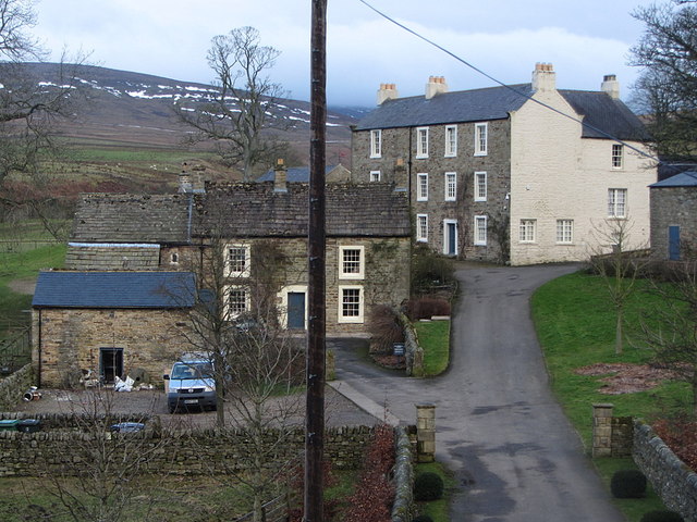
Burnstones
Confusingly renamed at some time as Knarsdale Hall with the old hall to the north east now called Knarsdale Barton NY6754 : Burnstones, Knarsdale Hall The OS maps have yet to catch up.
 Map © Crown Copyright")
TIP: Click the map for more Large scale mapping
- Grid Square
- NY6754, 81 images (more nearby 🔍)
- Photographer
- Andrew Curtis (more nearby)
- Date Taken
- Wednesday, 18 February, 2015 (more nearby)
- Submitted
- Wednesday, 18 February, 2015
- Subject Location
-
OSGB36:
 NY 6743 5434 [10m precision]
WGS84: 54:52.9646N 2:30.5515W - Camera Location
-
OSGB36: NY 6753 5437
- View Direction
- West-southwest (about 247 degrees)