2015
NS2477 : Gourock Pierhead development
taken 9 years ago, near to Gourock, Inverclyde, Scotland
This is 1 of 24 images, with title Gourock Pierhead development in this square
Gourock Pierhead development
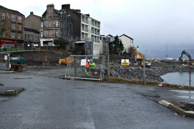
A new road under construction on the shore behind Kempock Street.
Gourock Pierhead development
The long awaited Gourock Pierhead development is now under construction. Planning approval was granted in 1999, the railway station was reconsructed in 2011, but the road re-alignment is only now coming to fruition. The new road is being built through the Kempock Street car park and on reclaimed land along the Firth of Clyde shore. This new road will relieve congestion on Kempock Street and will also provide safe cycling access from Gourock railway station to Gourock outdoor swimming pool.
 Map © Crown Copyright")
TIP: Click the map for more Large scale mapping
- Grid Square
- NS2477, 938 images (more nearby 🔍)
- Photographer
- Thomas Nugent (more nearby)
- Date Taken
- Monday, 16 February, 2015 (more nearby)
- Submitted
- Saturday, 21 February, 2015
- Subject Location
-
OSGB36:
 NS 2420 7796 [10m precision]
WGS84: 55:57.7427N 4:49.0766W - Camera Location
-
OSGB36: NS 2422 7797
- View Direction
- West-southwest (about 247 degrees)