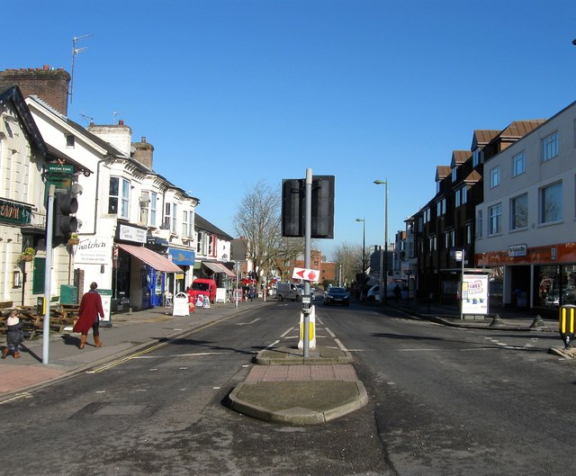
TQ3223 : The Broadway, Haywards Heath
taken 9 years ago, near to Haywards Heath, West Sussex, England
In 1825 a meeting of the great and good in Cuckfield rejected the proposed route of a railway through the small town and supported the route of another to the east midway between that village and Lindfield across a barren heath called Haywards Heath. For centuries the land had been open common with the only event of note a small skirmish in 1642 during the English Civil War when the Parliamentarians stopped a small force of Royalists marching from Chichester to take Lewes resulting in the latter losing 200 men. The arrival of the railway in 1841 would turn this barren heathland into a popular 20th century commuter town.
The bulk of modern Haywards Heath was once part of the parish of Cuckfield with parts to the east and south originally part of Lindfield, Wivelsfield and Keymer, and its growth from 1841 would eventually eclipse that of its much older neighbour. Initially a few buildings including a hotel were built in what is now Market Place and growth remained slow until the 1850s when firstly the remains of the common were enclosed in 1858 and St Francis Hospital at the southern edge of the town was opened the following year. After this growth was rapid, the town became an ecclesiastical parish in 1865, gained a purpose built cattle market in 1883, the law court arrived from neighbouring Cuckfield in 1888 whilst the town began expanding around South Road, Sussex Road, Perrymount Road, Paddockhall Road and Boltro Road, all highways that existed across the old heath prior to the construction of the town.
Despite this growth the town lacked a central commercial focal point which did not shift down to South Road until the last decades of the 19th century and thus pockets existed around the station along The Broadway and Sussex Road whilst many offices which moved to the town are situated around Boltro Road and Perrymount Road. During the 20th century the suburbs expanded outwards those around Queens Road, Ashernground road, Lucastes Road and Western Road appeared before the First World War; the triangle between Franklynns Road and Sussex road appeared between the wars along with a new estate at Franklands Village and housing spread north towards Lindfield. After the Second World War the expansion continued southwards towards Rocky Lane, westwards with the construction of the Harlands Estate and eastwards along America Lane. Franklands Village was expanded in the 1980s and since the beginning of the 21st century the area west of the railway and south of Bolnore has been developed on areas of former woodland.
The main road through the town is the A272 which for many decades caused all kinds of congestion during rush hours and has now finally been routed around the south of the town, the bypass opening in 2014. The B2112 runs north west through the town and is an old route predating the town's existence, one of a number of former London-Brighton turnpikes from the 18th century with this one once part of the road over Ditchling Beacon, through Ditchling, Lindfield and Ardingly northwards to the Surrey border. The current London-Brighton annual bike ride still follows this route. A minor but busy C road heads north from Commercial Square to Balcombe whilst Rocky Lane was once a minor route to Burgess Hill to the south but has now become part of the A272 bypass. To the south west is Isaacs Lane, the A273, which is the main connecting route to Burgess Hill. All other roads within the town are suburban.
 Map © Crown Copyright")
- Grid Square
- TQ3223, 146 images (more nearby 🔍)
- Photographer
- Simon Carey (more nearby)
- Date Taken
- Tuesday, 17 February, 2015 (more nearby)
- Submitted
- Sunday, 22 February, 2015
- Subject Location
-
OSGB36:
 TQ 3297 2397 [10m precision]
WGS84: 50:59.9859N 0:6.3833W - Camera Location
-
OSGB36: TQ 3295 2391
- View Direction
- North-northeast (about 22 degrees)