2015
SE5950 : Former chapel, South Bank Avenue
taken 9 years ago, near to Fulford, York, England
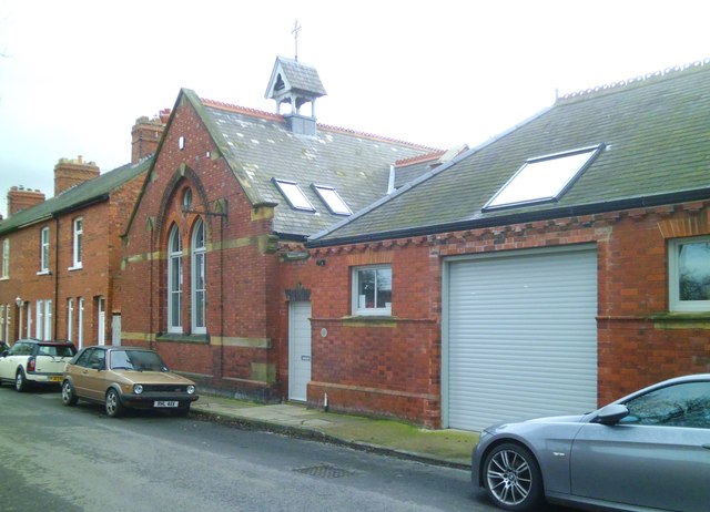
Former chapel, South Bank Avenue
This building appears on the OS 6" map of 1907 as a 'Mission Chapel' [or possibly Mission Church], but is not shown on any maps of a later [or earlier] date. One assumes that its use as a religious site was rather short, and I have no idea as to its current use.
 Map © Crown Copyright")
TIP: Click the map for more Large scale mapping
- Grid Square
- SE5950, 229 images (more nearby 🔍)
- Photographer
- Gordon Hatton (more nearby)
- Date Taken
- Friday, 20 February, 2015 (more nearby)
- Submitted
- Sunday, 22 February, 2015
- Subject Location
-
OSGB36:
 SE 5978 5040 [10m precision]
WGS84: 53:56.7757N 1:5.4416W - Camera Location
-
OSGB36: SE 5976 5042
- View Direction
- Southeast (about 135 degrees)