2015
SS8996 : Eastern boundary of Abergwynfi
taken 9 years ago, near to Abergwynfi, Neath Port Talbot/Castell-Nedd Port Talbot, Wales
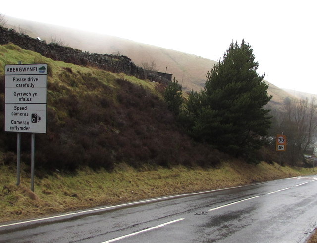
Eastern boundary of Abergwynfi
The A4107 reaches Abergwynfi, a village in the county borough of Neath Port Talbot.
This is the highest point in the village, at 315 metres (1,030 ft) above sea level.
A blowing drizzly mist made photography hard work, with frequent wiping of water from the lens.
This is the highest point in the village, at 315 metres (1,030 ft) above sea level.
A blowing drizzly mist made photography hard work, with frequent wiping of water from the lens.
 Map © Crown Copyright")
TIP: Click the map for more Large scale mapping
- Grid Square
- SS8996, 66 images (more nearby 🔍)
- Photographer
- Jaggery (more nearby)
- Date Taken
- Wednesday, 25 February, 2015 (more nearby)
- Submitted
- Wednesday, 25 February, 2015
- Subject Location
-
OSGB36:
 SS 8955 9604 [10m precision]
WGS84: 51:39.1360N 3:35.8758W - Camera Location
-
OSGB36: SS 8956 9604
- View Direction
- WEST (about 270 degrees)