TQ4075 : Kidbrooke village development near the station
taken 9 years ago, near to Kidbrooke, Greenwich, England
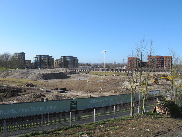
The Ferrier was a large council housing estate in Kidbrooke, Greenwich Borough, London. It was built in the late 1960s and early 1970s, mainly on what had been an RAF training and logistics base.
The housing - a mixture of 6-storey medium-rise and 12-storey high-rise blocks, was concrete panel construction, quick to erect but not of high quality. By the 1990s it had become known as a "sink" estate with high levels of crime.
From 1999, regeneration of the estate as a mixed (private/social) development by the council in partnership with private developers was planned. Demolition started in 2010 and occupation of new housing commenced in 2011, but the whole project, renamed "Kidbrooke Village", will take several years.
sources: Linkand Link
 Map © Crown Copyright")
- Grid Square
- TQ4075, 178 images (more nearby 🔍)
- Photographer
- Stephen Craven (more nearby)
- Date Taken
- Friday, 27 February, 2015 (more nearby)
- Submitted
- Friday, 27 February, 2015
- Subject Location
-
OSGB36:
 TQ 408 755 [100m precision]
WGS84: 51:27.7000N 0:1.6011E - Camera Location
-
OSGB36: TQ 409 756
- View Direction
- West-southwest (about 247 degrees)