2015
NZ2760 : 'Windy Nook', Whitehills
taken 9 years ago, near to Wrekenton, Gateshead, England
'Windy Nook', Whitehills
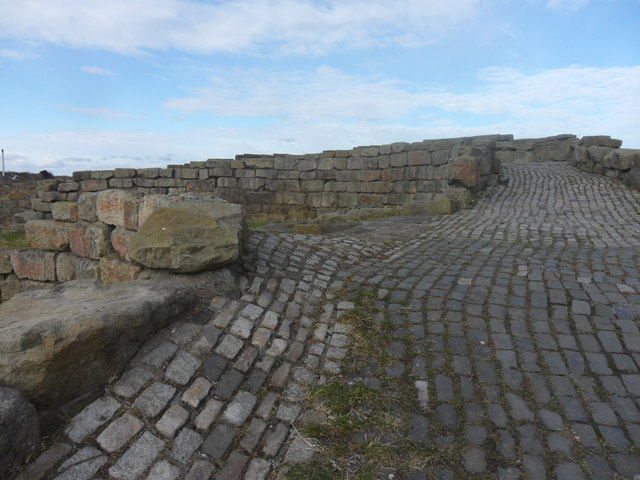
Richard Cole's Windy Nook, completed in 1986 transformed a former colliery slag heap and is noted for its excellent views.
At the summit is a terrace of concentric semi-circular stone walls and turfed earthworks incorporating 2,500 tons of granite recycled from pillars supporting the old Scotswood Bridge.
At the summit is a terrace of concentric semi-circular stone walls and turfed earthworks incorporating 2,500 tons of granite recycled from pillars supporting the old Scotswood Bridge.
 Map © Crown Copyright")
TIP: Click the map for more Large scale mapping
- Grid Square
- NZ2760, 27 images (more nearby 🔍)
- Photographer
- Anthony Foster (more nearby)
- Date Taken
- Wednesday, 25 February, 2015 (more nearby)
- Submitted
- Saturday, 28 February, 2015
- Subject Location
-
OSGB36:
 NZ 2779 6016 [10m precision]
WGS84: 54:56.1207N 1:34.0684W - Camera Location
-
OSGB36: NZ 2779 6015
- View Direction
- NORTH (about 0 degrees)