2008
SN0717 : Medieval fish pond, Llawhaden
taken 16 years ago, near to Llawhaden, Pembrokeshire/Sir Benfro, Wales
This is 1 of 3 images, with title Medieval fish pond, Llawhaden in this square
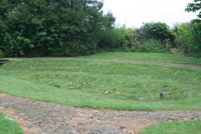
Medieval fish pond, Llawhaden
A fishpond is depicted on the 1st edition OS County series map and the field to the east was called 'Fishpond Meadow'. The pond is roughly square, about 42m across. The drainage channels hint at the former presence of two further ponds. The pond may be connected with the castle and may have formed part of a wider ornamental landscape. Most medieval fish-management sites had multiple ponds, typically two or three, but occasionally up to 12. Islands were common within medieval fishponds and they appear to have sat just above, or below, the surface. The functions of these islands is unclear.
 Map © Crown Copyright")
TIP: Click the map for more Large scale mapping
- Grid Square
- SN0717, 208 images (more nearby 🔍)
- Photographer
- Jo and Steve Turner (more nearby)
- Date Taken
- Friday, 9 May, 2008 (more nearby)
- Submitted
- Sunday, 1 March, 2015
- Subject Location
-
OSGB36:
 SN 0712 1738 [10m precision]
WGS84: 51:49.2999N 4:48.0041W - Camera Location
-
OSGB36: SN 0711 1739
- View Direction
- South-southeast (about 157 degrees)