2004
SK8971 : Where Lincolnshire meets Nottinghamshire
taken 19 years ago, near to Harby, Nottinghamshire, England
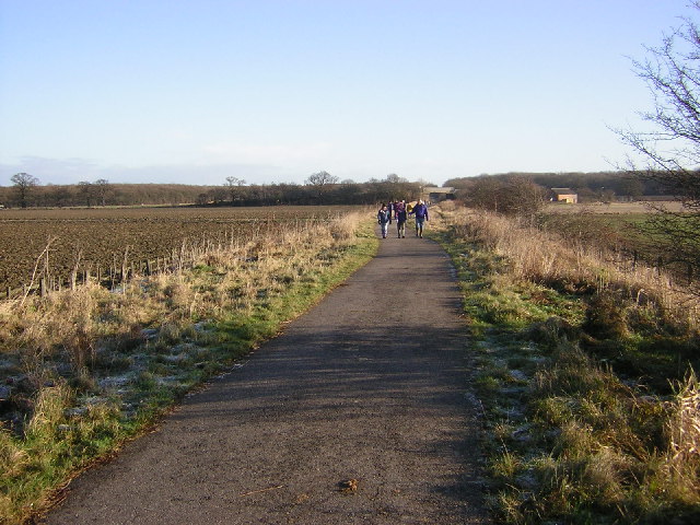
Where Lincolnshire meets Nottinghamshire
Looking east towards Doddington Road bridge along route 64 of the National Cycle network from the Notts./Lincs. county boundary. The route follows the disused GNER Chesterfield & Lincoln railway line. Boxing Day 2004
 Map © Crown Copyright")
TIP: Click the map for more Large scale mapping
- Grid Square
- SK8971, 58 images (more nearby 🔍)
- Photographer
- Richard Croft (more nearby)
- Date Taken
- Sunday, 26 December, 2004 (more nearby)
- Submitted
- Saturday, 27 August, 2005
- Subject Location
-
OSGB36:
 SK 89 71 [1000m precision]
WGS84: 53:13.9803N 0:39.6366W