2015
SE8673 : Thorpe Bassett
taken 9 years ago, near to Thorpe Bassett, North Yorkshire, England
This is 1 of 2 images, with title Thorpe Bassett in this square
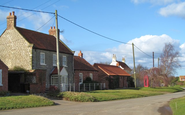
Thorpe Bassett
The main street of this little village tucked below the northern edge of the Wolds. One of these houses [probably the white gable end in the background] is shown as 'The Royal Oak PH' on the 1856 map.
 Map © Crown Copyright")
TIP: Click the map for more Large scale mapping
- Grid Square
- SE8673, 23 images (more nearby 🔍)
- Photographer
- Gordon Hatton (more nearby)
- Date Taken
- Wednesday, 4 March, 2015 (more nearby)
- Submitted
- Wednesday, 4 March, 2015
- Subject Location
-
OSGB36:
 SE 8620 7303 [10m precision]
WGS84: 54:8.7526N 0:40.9107W - Camera Location
-
OSGB36: SE 8621 7300
- View Direction
- North-northwest (about 337 degrees)