2014
SZ0285 : Studland and Godlingston Heath National Nature Reserve and Poole Harbour
taken 9 years ago, near to Sandbanks, Bournemouth, Christchurch & Poole, England
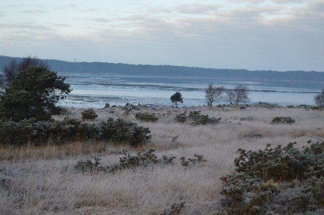
Studland and Godlingston Heath National Nature Reserve and Poole Harbour
The Studland and Godlingston Heaths NNR is located on the Isle of Purbeck in Dorset. It borders Studland Bay on the south side of Poole Harbour, between the settlements of Swanage and Sandbanks. Extending to 631ha, it is owned and managed by the National Trust following the Bankes bequest of the Kingston Lacy estate. Studland & Godlingston Heath is designated as one of only 35 "spotlight reserves" in England by Natural England in the list of national nature reserves in England and is listed as a Site of Special Scientific Interest (SSSI).
The reserve predominantly consists of internationally important lowland heath but also has a wide range of habitats including sand dune, peat bog, alder and willow carr, freshwater lagoons such as the "Little Sea", and 5 km of sandy beach. All six species of native British reptiles are found here including the rare and nationally-endangered Sand Lizard and Smooth Snake.
Wikipedia: Link
See other images of Studland and Godlingston Heath National Nature Reserve
 Map © Crown Copyright")
TIP: Click the map for more Large scale mapping
- Grid Square
- SZ0285, 32 images (more nearby 🔍)
- Photographer
- N Chadwick (more nearby)
- Date Taken
- Tuesday, 30 December, 2014 (more nearby)
- Submitted
- Thursday, 5 March, 2015
- Subject Location
-
OSGB36:
 SZ 0263 8561 [10m precision]
WGS84: 50:40.2091N 1:57.8488W - Camera Location
-
OSGB36: SZ 0277 8542
- View Direction
- Northwest (about 315 degrees)