2015
TQ2351 : Disused sand processing plant
taken 9 years ago, near to Buckland, Surrey, England
This is 1 of 2 images, with title Disused sand processing plant in this square
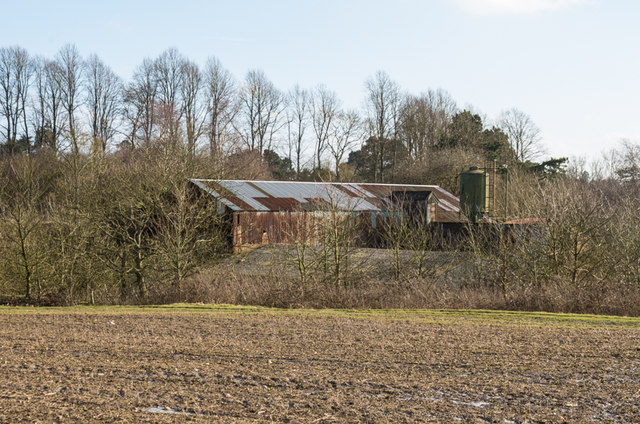
Disused sand processing plant
Given its site next to a large former sand quarry (see TQ2351 : Tap Wood Pit), this presumably is a disused processing plant. Until ceasing operation 2014, sand from Tap Wood Pit was for many years processed in nearby Park Pit, on the other side of the A25.
 Map © Crown Copyright")
TIP: Click the map for more Large scale mapping
- Grid Square
- TQ2351, 74 images (more nearby 🔍)
- Photographer
- Ian Capper (more nearby)
- Date Taken
- Sunday, 1 March, 2015 (more nearby)
- Submitted
- Monday, 9 March, 2015
- Subject Location
-
OSGB36:
 TQ 233 510 [100m precision]
WGS84: 51:14.7255N 0:14.0611W - Camera Location
-
OSGB36: TQ 233 511
- View Direction
- South-southeast (about 157 degrees)