Geograph - photograph every grid square
2015
ST5675
: Durdham Down
taken
9 years ago
,
near
to
Redland
, Bristol, England
This is 1 of
4 images, with title Durdham Down
in this square
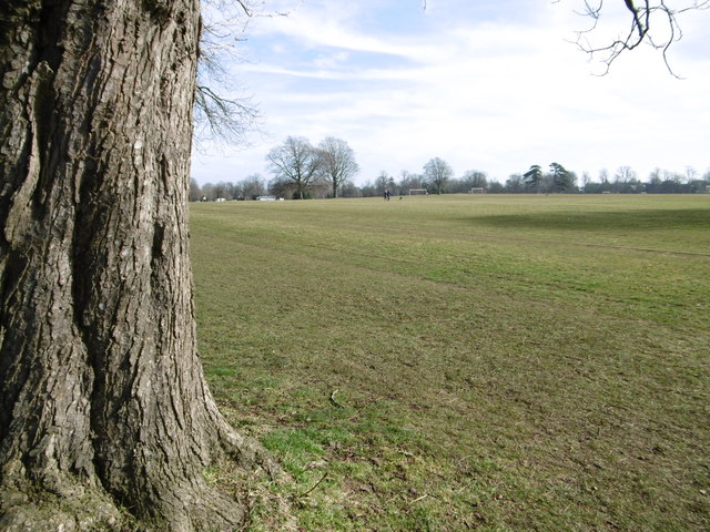
Durdham Down
A large expanse of open space acquired by the City Corporation in 1857, to prevent housing sprawl.
© Copyright
Mike Faherty
and licensed for
reuse
under this
Creative Commons Licence
.
Licensing
Download
More Sizes
Share...
Share this photo via Twitter
Share this photo via Facebook
Share this photo via Pinterest
Share this photo via Flipboard
Share this photo via email/e-card
Grab a Stamped/Watermarked Image
Mark
👍🏻
Like Image
👍🏻
Like Description
Update Information
Contact Contributor
Geographical Context:
Lowlands
Park and Public Gardens
Suburb, Urban fringe
Primary Subject:
Downland
other tags:
Common Land
Click a tag, to view other nearby images.
TIP: Click the map for more Large scale mapping
Grid Square
ST5675
, 148 images (
more nearby
🔍
)
Photographer
Mike Faherty
(
more nearby
)
Date Taken
Saturday, 7 March, 2015 (
more nearby
)
Submitted
Tuesday, 10 March, 2015
Subject Location
OSGB36:
ST 5685 7542
[10m precision]
WGS84:
51:28.5651N
2:37.3617W
Camera Location
OSGB36:
ST 5685 7542
View Direction
EAST (about 90 degrees)
NW
N
NE
W
Go
E
SW
S
SE
Discuss ST5675
View this location on ...
Geograph Coverage Map (includes OSM etc)
Geograph Links Page
Open in Google Maps
Navigate to location with Google Maps
Open in Google Earth Pro
Open in Google Earth for Web
Open in Bing Maps
Navigate with Google Maps
Lookup nearest Postcode
Image classification
(about)
: Geograph
This page has been
viewed
about
9
times
☰
Home
View
Search
Marked Images
Maps
Browser
Explore
Showcase
New Images
Collections
Interact
Games
Discussions
Blog
Contributors
Submit
Statistics
Leaderboards
General
FAQ
Help Pages
Sitemap
Contact Us
Support Us
sponsored by
🔍
What to search:
Photos
Enter keywords or a location/postcode to search nearby images
Photos near ST5675
Enter a Grid Reference
Placenames
Collections
Website Pages
Everything
Others:
Advanced Search
|
Image Browser
Or:
Coverage Map
|
Searchable Map
You are not logged in
login
|
register