2007
SJ6972 : Farm track to Melvin Holme
taken 17 years ago, near to Lostock Green, Cheshire West And Chester, England
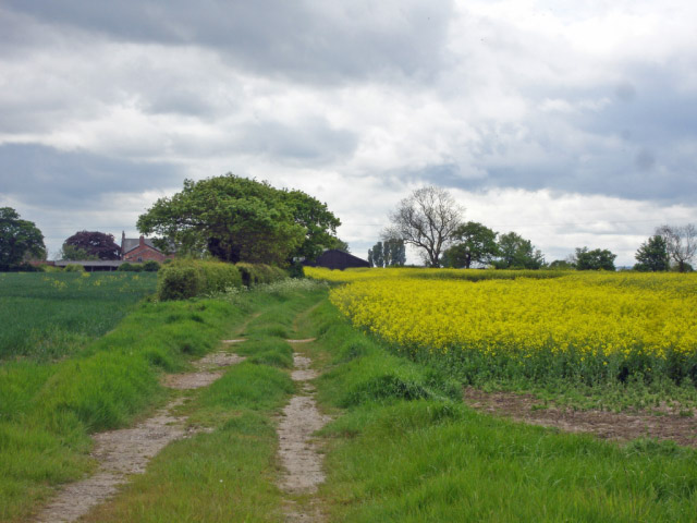
Farm track to Melvin Holme
Farm track to Melvin Holme, from the footpath N of Penny's Lane, Lach Dennis. Line of the unreinstated footpath continues half right through the rape, so the field edge track is the only possible way to proceed!
 Map © Crown Copyright")
TIP: Click the map for more Large scale mapping
- Grid Square
- SJ6972, 5 images (more nearby 🔍)
- Photographer
- Mike Harris (more nearby)
- Date Taken
- Monday, 7 May, 2007 (more nearby)
- Submitted
- Sunday, 20 May, 2007
- Subject Location
-
OSGB36:
 SJ 6945 7292 [10m precision]
WGS84: 53:15.1443N 2:27.5605W - Camera Location
-
OSGB36: SJ 6945 7292
- View Direction
- Southwest (about 225 degrees)