2015
SJ8498 : Rochdale Canal, lock No. 84
taken 9 years ago, near to Manchester, England
This is 1 of 37 images, with title starting with Rochdale Canal in this square
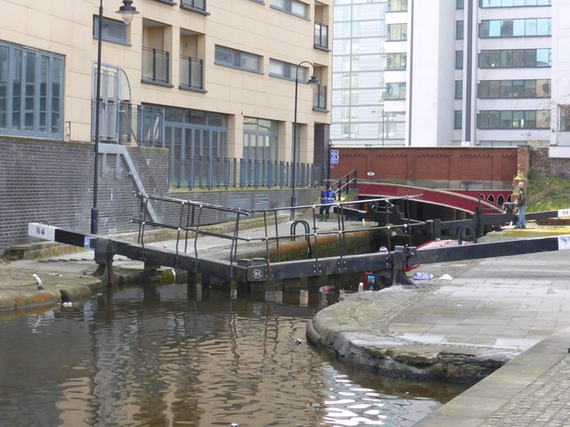
Rochdale Canal, lock No. 84
I had 20 minutes at lunchtime for a quick explore of the Rochdale Canal. I must say this taster would make me really keen to do some Manchester canal walking.
Rochdale Canal
The Rochdale Canal runs for 33 miles between Manchester and Sowerby Bridge in West Yorkshire, UK. In Sowerby Bridge it connects with the Calder and Hebble Navigation. In Manchester it connects with the Ashton and Bridgewater Canals.
The canal was opened between Sowerby Bridge and Todmorden and from Manchester to Rochdale in 1799 and between Todmorden and Rochdale in 1805. Most of the canal was closed in 1952. Restoration work began in late 1980s and by 1996 the canal was opened to navigation once again between Sowerby Bridge and the summit level. The canal was re-opened to navigation along its entire length in July 2002 and forms part of the South Pennine Ring.
Link
 Map © Crown Copyright")
TIP: Click the map for more Large scale mapping
- Grid Square
- SJ8498, 3904 images (more nearby 🔍)
- Photographer
- Chris Allen (more nearby)
- Date Taken
- Wednesday, 18 March, 2015 (more nearby)
- Submitted
- Thursday, 19 March, 2015
- Subject Location
-
OSGB36:
 SJ 8474 9814 [10m precision]
WGS84: 53:28.7855N 2:13.8843W - Camera Location
-
OSGB36: SJ 8476 9816
- View Direction
- Southwest (about 225 degrees)