2015
HP6514 : Burn of Norwick on Norwick beach
taken 9 years ago, near to Norwick, Unst, Shetland Islands, Scotland
This is 1 of 81 images, with title Burn of Norwick on Norwick beach in this square
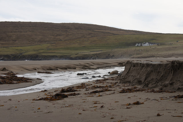
Burn of Norwick on Norwick beach
High tides have moved the burn again, with sand blocking the outflow and damming the burn until it burst through again, still north of the Taing.
 Map © Crown Copyright")
TIP: Click the map for more Large scale mapping
- Grid Square
- HP6514, 739 images (more nearby 🔍)
- Photographer
- Mike Pennington (more nearby)
- Date Taken
- Saturday, 21 March, 2015 (more nearby)
- Submitted
- Sunday, 22 March, 2015
- Subject Location
-
OSGB36:
 HP 6522 1455 [10m precision]
WGS84: 60:48.5109N 0:48.1911W - Camera Location
-
OSGB36: HP 6521 1457
- View Direction
- SOUTH (about 180 degrees)