2015
NR1651 : Benchmark on 6 Main Street, Port Wemyss, Islay
taken 9 years ago, near to Port Wemyss, Islay, Argyll And Bute, Scotland
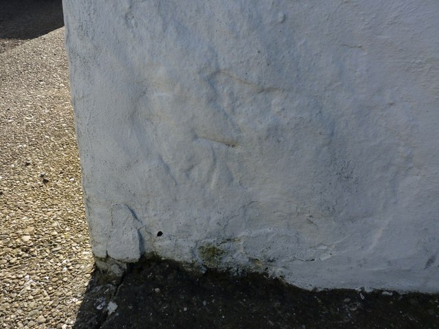
Benchmark on 6 Main Street, Port Wemyss, Islay
This Ordnance Survey cut benchmark is very faded, but still visible on the side of this house. For full description, see Link .
.
 Map © Crown Copyright")
TIP: Click the map for more Large scale mapping
- Grid Square
- NR1651, 61 images (more nearby 🔍)
- Photographer
- Becky Williamson (more nearby)
- Date Taken
- Tuesday, 24 March, 2015 (more nearby)
- Submitted
- Tuesday, 24 March, 2015
- Subject Location
-
OSGB36:
 NR 1692 5176 [10m precision]
WGS84: 55:40.5910N 6:30.2685W - Camera Location
-
OSGB36: NR 16928 51776
- View Direction
- West-southwest (about 247 degrees)