2015
SS5532 : Moving earth on Bridge Wharf
taken 9 years ago, near to Sticklepath, Devon, England
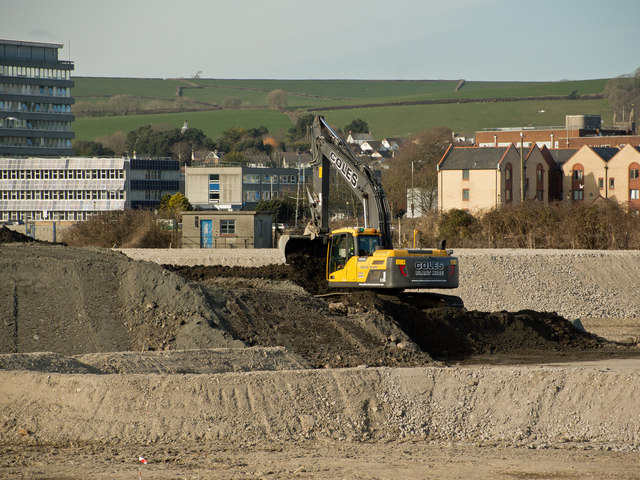
Moving earth on Bridge Wharf
In the background, to the right, is the Civic Centre. To the right of the Civic Centre is the Police Station. The brick building to the right of the image is Castle Quay Court.
Bridge Wharf (Anchorwood Bank), Barnstaple
Recently the site of the Shapland & Petter Raleigh Cabinet Works and prior to this a shipbuilding yard known as Bridge Wharf or Taw Wharf. This site is now referred to as Anchorwood Bank although it is only the periphery bordering on the River Taw which has been known as such.
For information on this development visit this site: Link
 Map © Crown Copyright")
TIP: Click the map for more Large scale mapping
- Grid Square
- SS5532, 857 images (more nearby 🔍)
- Photographer
- Roger A Smith (more nearby)
- Date Taken
- Wednesday, 25 March, 2015 (more nearby)
- Submitted
- Friday, 27 March, 2015
- Subject Location
-
OSGB36:
 SS 5544 3290 [10m precision]
WGS84: 51:4.6298N 4:3.8992W - Camera Location
-
OSGB36: SS 5541 3278
- View Direction
- North-northeast (about 22 degrees)