2014
TL4555 : Former field boundary
taken 9 years ago, near to Trumpington, Cambridgeshire, England
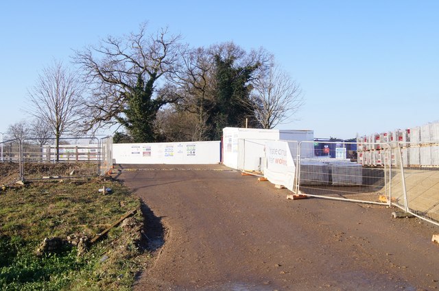
Former field boundary
See TL4555 : Fields divided by a ditch for a similar view taken Dec 2008 which I took shortly after learning the planned housing development was likely to take place. Six years later work is rapidly progressing. I am very glad Geograph gave me the opportunity to record and document this permanent change.
 Map © Crown Copyright")
TIP: Click the map for more Large scale mapping
- Grid Square
- TL4555, 1570 images (more nearby 🔍)
- Photographer
- Mr Ignavy (more nearby)
- Date Taken
- Sunday, 28 December, 2014 (more nearby)
- Submitted
- Monday, 30 March, 2015
- Subject Location
-
OSGB36:
 TL 4523 5533 [10m precision]
WGS84: 52:10.6269N 0:7.3518E - Camera Location
-
OSGB36: TL 4530 5532
- View Direction
- WEST (about 270 degrees)