2015
SH6559 : Lake Becomes Stream
taken 9 years ago, near to Pont Pen-y-Benglog, Conwy, Wales
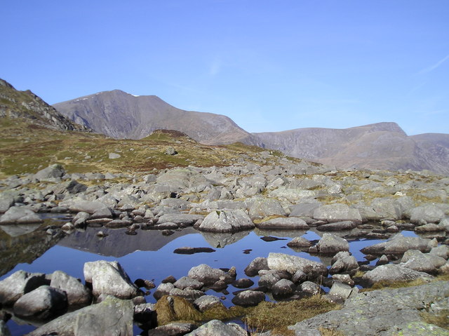
Lake Becomes Stream
The start of Nant Bochlwyd or the edge of Llyn Bochlwyd? Y Garn in the distance.
 Map © Crown Copyright")
TIP: Click the map for more Large scale mapping
- Grid Square
- SH6559, 77 images (more nearby 🔍)
- Photographer
- Chris Andrews (more nearby)
- Date Taken
- Sunday, 22 March, 2015 (more nearby)
- Submitted
- Tuesday, 31 March, 2015
- Subject Location
-
OSGB36:
 SH 6555 5941 [10m precision]
WGS84: 53:6.8924N 4:0.6156W - Camera Location
-
OSGB36: SH 6558 5941
- View Direction
- WEST (about 270 degrees)