2015
NG4927 : Bog in Glen Sligachan
taken 9 years ago, 5 km SSW of Sconser, Isle of Skye, Scotland
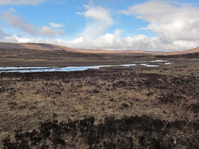
Bog in Glen Sligachan
A large area of bog makes about half of this grid square a no-go area - on foot at least. The footpath marked on the OS maps is reasonably well made, though is crossed by many small burns which, in wetter weather (ie, most of the time) need some deft stepping-stone skipping in order to get across with dry feet.
 Map © Crown Copyright")
TIP: Click the map for more Large scale mapping
- Grid Square
- NG4927, 17 images (more nearby 🔍)
- Photographer
- Richard Dorrell (more nearby)
- Date Taken
- Tuesday, 24 March, 2015 (more nearby)
- Submitted
- Tuesday, 31 March, 2015
- Subject Location
-
OSGB36:
 NG 4941 2791 [10m precision]
WGS84: 57:16.3740N 6:9.5150W - Camera Location
-
OSGB36: NG 4949 2779
- View Direction
- North-northwest (about 337 degrees)