2015
NU1835 : War Memorial, Bamburgh Castle
taken 9 years ago, near to Bamburgh, Northumberland, England
This is 1 of 2 images, with title War Memorial, Bamburgh Castle in this square
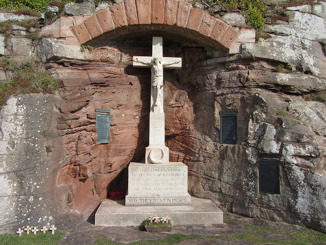
War Memorial, Bamburgh Castle
As shown here NU1835 : Cliffs on the south side of Bamburgh Castle the dark grey, blocky rock on which the castle stands is quartz dolerite, part of the Whin Sill. It was intruded as molten rock at a high temperature between the layers of sedimentary rocks, taking on its distinctive columnar, vertically-jointed form as it cooled and crystalised. The dolerite layer on which the castle stands is about 10m thick as it is along Hadrian's Wall. Below the dolerite, at the level of the war memorial, the pinkish coloured rocks are sandstone laid down in extensive horizontal layers. Between these layers there are fine striations cross-cutting at different angles. These are sandstones laid down by ancient rivers, with the fine striations - called cross-bedding - a feature of sediments laid down as ripples.
 Map © Crown Copyright")
TIP: Click the map for more Large scale mapping
- Grid Square
- NU1835, 547 images (more nearby 🔍)
- Photographer
- Andrew Curtis (more nearby)
- Date Taken
- Sunday, 15 March, 2015 (more nearby)
- Submitted
- Saturday, 4 April, 2015
- Subject Location
-
OSGB36:
 NU 1828 3508 [10m precision]
WGS84: 55:36.5391N 1:42.6835W - Camera Location
-
OSGB36: NU 1828 3507
- View Direction
- Northeast (about 45 degrees)