2015
NZ5020 : Former WW1 drill hall complex from the south-east
taken 9 years ago, near to Middlesbrough, England
This is 1 of 3 images, with title starting with Former WW1 drill hall complex from the in this square
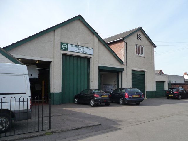
Former WW1 drill hall complex from the south-east
Described as ' walled compound [now Abingdon Road car park] with WD marker stone at one corner and gatepost, hall with two-storey orderly room block alongside and garage; on other side a later single storey building'. The building is now used as NACRO's Middlesbrough Training Centre.
 Map © Crown Copyright")
TIP: Click the map for more Large scale mapping
- Grid Square
- NZ5020, 129 images (more nearby 🔍)
- Photographer
- Christine Johnstone (more nearby)
- Date Taken
- Thursday, 2 April, 2015 (more nearby)
- Submitted
- Wednesday, 8 April, 2015
- Subject Location
-
OSGB36:
 NZ 5004 2011 [10m precision]
WGS84: 54:34.4243N 1:13.6473W - Camera Location
-
OSGB36: NZ 5006 2009
- View Direction
- Northwest (about 315 degrees)