1992
SH7352 : Dolwyddelan and Moel Siabod (2,866 ft.), 1992
taken 32 years ago, near to Pentre-Bont, Conwy, Wales
This is 1 of 2 images, with title starting with Dolwyddelan and Moel in this square
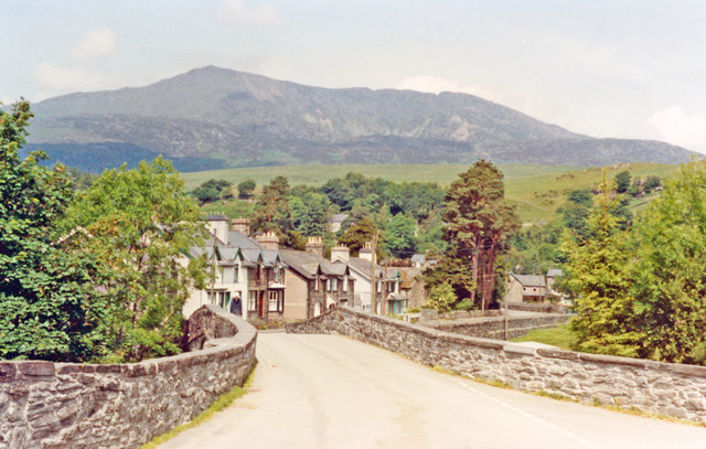
Dolwyddelan and Moel Siabod (2,866 ft.), 1992
View NW from by the station.
 Map © Crown Copyright")
TIP: Click the map for more Large scale mapping
- Grid Square
- SH7352, 196 images (more nearby 🔍)
- Photographer
- Ben Brooksbank (more nearby)
- Date Taken
- Thursday, 25 June, 1992 (more nearby)
- Submitted
- Sunday, 19 April, 2015
- Subject Location
-
OSGB36:
 SH 737 521 [100m precision]
WGS84: 53:3.0879N 3:53.1334W - Camera Location
-
OSGB36: SH 737 521
- View Direction
- South-southwest (about 202 degrees)