2015
SJ8793 : Fallowfield Loop
taken 9 years ago, near to Levenshulme, Manchester, England
This is 1 of 2 images, with title starting with Fallowfield in this square
Fallowfield Loop
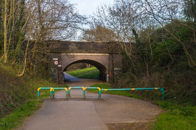
Bridge carrying Alma Road across the disused railway line, the Fallowfield Loop.
Fallowfield Loop
The Fallowfield Loop is an off-road cycle path, pedestrian and horse riding route from Chorlton through Fallowfield and Levenshulme to Gorton and Fairfield in Manchester. The Fallowfield loop was previously part of the old 'Manchester Central Station Railway', built in the 1890s and closed in 1988. Link
 Map © Crown Copyright")
TIP: Click the map for more Large scale mapping
- Grid Square
- SJ8793, 82 images (more nearby 🔍)
- Photographer
- Peter McDermott (more nearby)
- Date Taken
- Monday, 20 April, 2015 (more nearby)
- Submitted
- Saturday, 25 April, 2015
- Subject Location
-
OSGB36:
 SJ 8725 9377 [10m precision]
WGS84: 53:26.4328N 2:11.6044W - Camera Location
-
OSGB36: SJ 87184 93778
- View Direction
- EAST (about 90 degrees)