2014
SY9582 : Corfe Castle
taken 9 years ago, near to Corfe Castle, Dorset, England
This is 1 of 133 images, with title Corfe Castle in this square
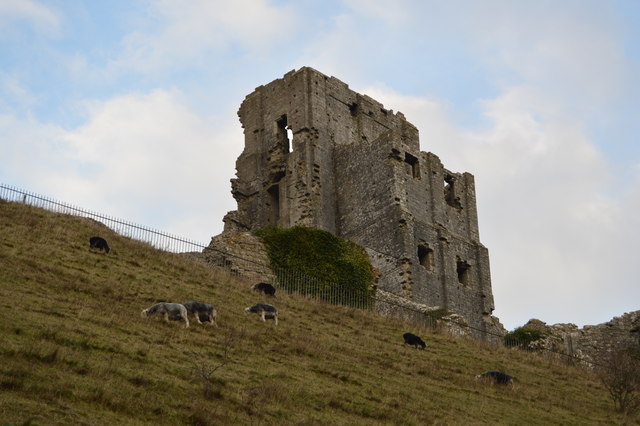
Corfe Castle
The castle dates back to the 11th century, and commands a gap in the Purbeck Hills on the route between Wareham and Swanage.
During the Civil War the castle was besieged. The first siege, in 1643, lasted for six weeks before the Parliamentarians withdrew. The second siege, in 1646, was resisted for two months before the castle was betrayed by a member of the garrison. After this the castle was destroyed.
The castle is now managed by the National Trust.
Website: Link
See other images of Corfe Castle
 Map © Crown Copyright")
TIP: Click the map for more Large scale mapping
- Grid Square
- SY9582, 669 images (more nearby 🔍)
- Photographer
- N Chadwick (more nearby)
- Date Taken
- Wednesday, 31 December, 2014 (more nearby)
- Submitted
- Saturday, 25 April, 2015
- Subject Location
-
OSGB36:
 SY 9584 8227 [10m precision]
WGS84: 50:38.4063N 2:3.6115W - Camera Location
-
OSGB36: SY 9580 8223
- View Direction
- Northeast (about 45 degrees)