2015
SO2556 : Pond on Hergest Ridge
taken 9 years ago, near to Upper Hergest, County of Herefordshire, England
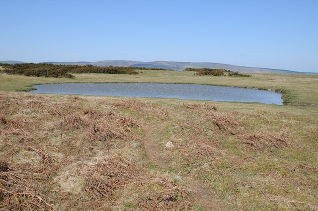
Pond on Hergest Ridge
One of a number of ponds on the broad open grazing land which is Hergest Ridge. Black Mixen can be seen in the background, always recognisable by it radio mast near its summit.
 Map © Crown Copyright")
TIP: Click the map for more Large scale mapping
- Grid Square
- SO2556, 68 images (more nearby 🔍)
- Photographer
- Philip Halling (more nearby)
- Date Taken
- Saturday, 18 April, 2015 (more nearby)
- Submitted
- Tuesday, 28 April, 2015
- Subject Location
-
OSGB36:
 SO 2561 5647 [10m precision]
WGS84: 52:12.0851N 3:5.3939W - Camera Location
-
OSGB36: SO 2562 5647
- View Direction
- West-northwest (about 292 degrees)