2015
SN9368 : Pant y Llyn
taken 9 years ago, 3 km from Llansantffraed-Cwmdeuddwr, Powys, Wales
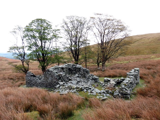
Pant y Llyn
Adfeilion anhedd-dy diarffordd yr ucheldir a elwir Pantyllyn. Enwyd y ty ar ol y nant gerllaw.
Ruins of a remote upland property known as Pantyllyn (trans. lake hollow) which is named after the nearby stream.
Ruins of a remote upland property known as Pantyllyn (trans. lake hollow) which is named after the nearby stream.
 Map © Crown Copyright")
TIP: Click the map for more Large scale mapping
- Grid Square
- SN9368, 9 images (more nearby 🔍)
- Photographer
- Alan Richards (more nearby)
- Date Taken
- Sunday, 3 May, 2015 (more nearby)
- Submitted
- Sunday, 3 May, 2015
- Subject Location
-
OSGB36:
 SN 9355 6887 [10m precision]
WGS84: 52:18.4555N 3:33.7653W - Camera Location
-
OSGB36: SN 9353 6884
- View Direction
- North-northeast (about 22 degrees)