2015
SD7844 : Downham Church of England School, Main Street
taken 9 years ago, near to Downham, Lancashire, England
This is 1 of 33 images, with title starting with Downham in this square
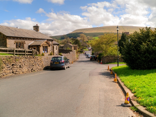
Downham Church of England School, Main Street
Downham is a small rural village to the north east of Clitheroe. The village is scattered beside a minor road which runs from Chatburn in a south-easterly direction down the slope to the valley bottom before ascending the eastern slopes of Pendle Hill. The road forms the main route through the village and is called, not surprisingly, Main Street.
The former School, now home to a pre-school group, was built in 1839 using limestone walls with sandstone dressings and a slate roof. It is a grade II listed building (English Heritage Building ID: 183340 Link British Listed Buildings).
The former School, now home to a pre-school group, was built in 1839 using limestone walls with sandstone dressings and a slate roof. It is a grade II listed building (English Heritage Building ID: 183340 Link
 Map © Crown Copyright")
TIP: Click the map for more Large scale mapping
- Grid Square
- SD7844, 174 images (more nearby 🔍)
- Photographer
- David Dixon (more nearby)
- Date Taken
- Thursday, 7 May, 2015 (more nearby)
- Submitted
- Saturday, 9 May, 2015
- Subject Location
-
OSGB36:
 SD 785 442 [100m precision]
WGS84: 53:53.6170N 2:19.7092W - Camera Location
-
OSGB36: SD 785 442
- View Direction
- Southeast (about 135 degrees)