2015
SO5964 : Water supply to Birchley Mill, Bockleton
taken 9 years ago, near to St Michaels, Worcestershire, England
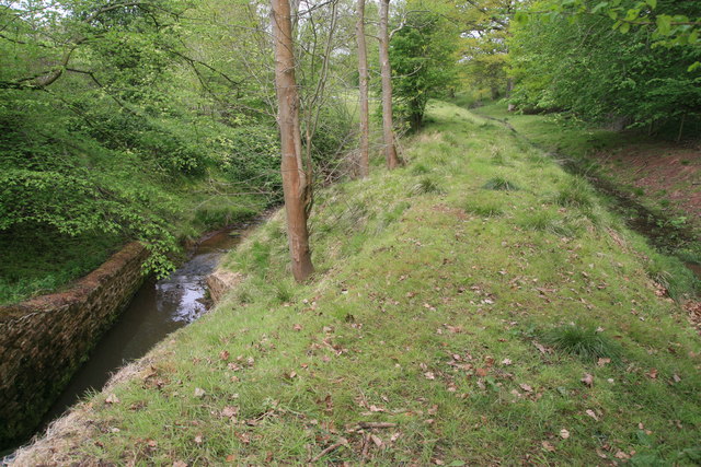
Water supply to Birchley Mill, Bockleton
The tail of the steep weir is seen to the left with the shallow leat leading towards the mill on the right. The weir has been rebuilt and the sluice leading to the leat reinstated with a plastic pipe feeding it. The water is taken from the Cadmore Brook
 Map © Crown Copyright")
TIP: Click the map for more Large scale mapping
- Grid Square
- SO5964, 13 images (more nearby 🔍)
- Photographer
- Chris Allen (more nearby)
- Date Taken
- Sunday, 10 May, 2015 (more nearby)
- Submitted
- Sunday, 10 May, 2015
- Subject Location
-
OSGB36:
 SO 5918 6437 [10m precision]
WGS84: 52:16.5572N 2:35.9818W - Camera Location
-
OSGB36: SO 5919 6437
- View Direction
- West-northwest (about 292 degrees)