1995
SM8010 : St Brides Haven
taken 29 years ago, near to St Brides, Pembrokeshire/Sir Benfro, Wales
This is 1 of 10 images, with title St Brides Haven in this square
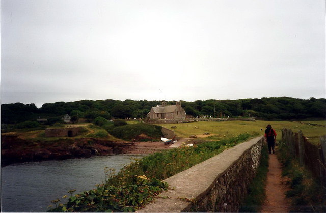
St Brides Haven
Llwybr yr arfordir yn agosau at Eglwys St Brides a welir yn y pellter.
Coastal path approaching St Brides Church visible in the distance.
Coastal path approaching St Brides Church visible in the distance.
 Map © Crown Copyright")
TIP: Click the map for more Large scale mapping
- Grid Square
- SM8010, 121 images (more nearby 🔍)
- Photographer
- Alan Richards (more nearby)
- Date Taken
- Tuesday, 4 July, 1995 (more nearby)
- Submitted
- Friday, 22 May, 2015
- Subject Location
-
OSGB36:
 SM 8010 1091 [10m precision]
WGS84: 51:45.2161N 5:11.2446W - Camera Location
-
OSGB36: SM 8006 1093
- View Direction
- East-southeast (about 112 degrees)