2015
SE0226 : Gate on Twine Lane at Twine, Mytholmroyd
taken 9 years ago, near to Midgley, Calderdale, England
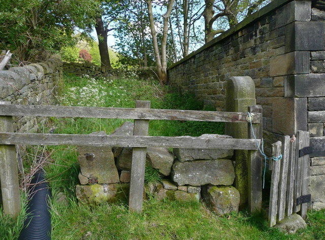
Gate on Twine Lane at Twine, Mytholmroyd
This is on Hebden Royd FP36. The cottage or farm captioned 'Twine' on the 1850 six-inch map was on the left, unless the lane has been moved. It is not shown on the 1893 1:2500 map. The building on the right is an agricultural store or shelter.
 Map © Crown Copyright")
TIP: Click the map for more Large scale mapping
- Grid Square
- SE0226, 254 images (more nearby 🔍)
- Photographer
- Humphrey Bolton (more nearby)
- Date Taken
- Monday, 18 May, 2015 (more nearby)
- Submitted
- Friday, 22 May, 2015
- Subject Location
-
OSGB36:
 SE 0240 2634 [10m precision]
WGS84: 53:44.0068N 1:57.9059W - Camera Location
-
OSGB36: SE 0240 2634
- View Direction
- East-southeast (about 112 degrees)