2015
J3775 : Holywood Road development site, Belfast - May 2015(5)
taken 9 years ago, 4 km ENE of Belfast, Co Antrim, Northern Ireland
Holywood Road development site, Belfast - May 2015(5)
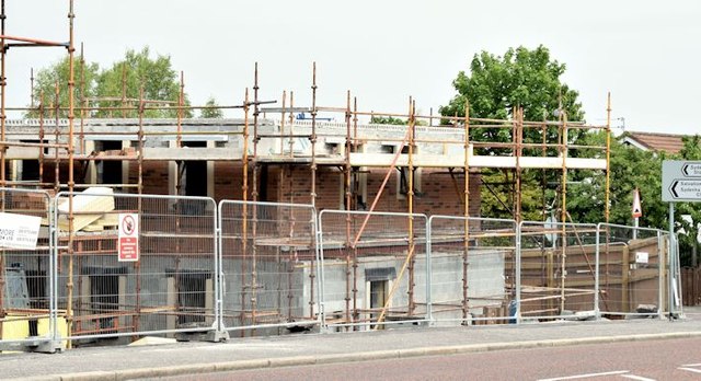
The block at the corner of the Holywood Road and the Station Road (right).
Holywood Road/Station Road, Belfast - new social housing
A vacant site for which there is the following application for planning permission Z/2013/0713/F 25/06/2013 290 - 292 Holywood Road and 2 - 4 Station Road Belfast Supported living scheme comprising of 18 apartments and 1 shared house (4 people) and associated works. The photographs submitted by me appear as a matter of geographical and historical record only. I have no connection with anyone involved in the proposed development and do not express any opinion, for or against it.
Note added 22 November 2014: the site formerly occupied by nos 290 and 292 Holywood Road Link has been incorporated into this one.
Loading map... (JavaScript required)
- Grid Square
- J3775, 1799 images (more nearby 🔍)
- Photographer
- Albert Bridge (more nearby)
- Date Taken
- Saturday, 23 May, 2015 (more nearby)
- Submitted
- Sunday, 24 May, 2015
- Subject Location
-
Irish:
 J 376 751 [100m precision]
WGS84: 54:36.3711N 5:52.2762W - Camera Location
-
Irish: J 376 751
- View Direction
- NORTH (about 0 degrees)