2015
SX5258 : Cann Quarry Canal
taken 9 years ago, 3 km from Crownhill, Plymouth, England
This is 1 of 3 images, with title Cann Quarry Canal in this square
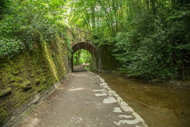
Cann Quarry Canal
The canal was only about two miles long; here it passes under the disused Plymouth - Tavistock Branch railway. The bridge now carries the NCN 27 cycle path.
 Map © Crown Copyright")
TIP: Click the map for more Large scale mapping
- Grid Square
- SX5258, 64 images (more nearby 🔍)
- Photographer
- Guy Wareham (more nearby)
- Date Taken
- Saturday, 30 May, 2015 (more nearby)
- Submitted
- Saturday, 30 May, 2015
- Subject Location
-
OSGB36:
 SX 5243 5866 [10m precision]
WGS84: 50:24.5538N 4:4.6899W - Camera Location
-
OSGB36: SX 5242 5863
- View Direction
- North-northeast (about 22 degrees)