2009
TQ3734 : Kingscote Vineyards Mill Place Farm Vowels Lane East Grinstead from Bluebell Railway
taken 15 years ago, near to Saint Hill, West Sussex, England
Kingscote Vineyards Mill Place Farm Vowels Lane East Grinstead from Bluebell Railway
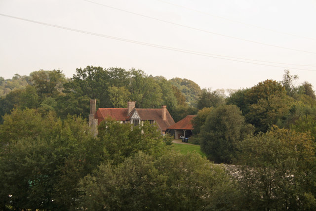
Addressed in the listing as Turner's Hill Road Mill Place Farmhouse is a 16th century and later Grade II Listed 'H' shaped farm house with a fine Elizabethan chimney stack. The estates website claims the former iron masters hall house was built about 1320 on a Roman iron ore extraction site. The area prospered as a foundry until the end of the English Civil War in the mid 17th century. English horticulturist and author William Robinson owned the 1000 acre Gravetye Estate and on his death in 1935 left the estate to nation to be used for the study of forestry. Christen Monge bought the 150 acre Kingscote Estate from the Forestry Commission in 1998 and completely restored the house.
Bluebell Railway :: TQ4023
The volunteer run Bluebell Line was the UK's first preserved standard gauge passenger railway, re-opening part of the Lewes to East Grinstead line of the old London Brighton & South Coast Railway in 1960. Since then it has developed into one of the largest tourist attractions in Sussex,
it still remains true to its objectives of the preservation for posterity of a country branch line, its steam locomotives, coaches and goods stock, signalling systems, stations and operating practices.
Website: Link
 Map © Crown Copyright")
TIP: Click the map for more Large scale mapping
- Grid Square
- TQ3734, 178 images (more nearby 🔍)
- Photographer
- Jo and Steve Turner (more nearby)
- Date Taken
- Sunday, 20 September, 2009 (more nearby)
- Submitted
- Sunday, 7 June, 2015
- Subject Location
-
OSGB36:
 TQ 3734 3482 [10m precision]
WGS84: 51:5.7749N 0:2.4022W - Camera Location
-
OSGB36: TQ 3714 3482
- View Direction
- EAST (about 90 degrees)