2015
NS4277 : Path beside old sheepfold
taken 9 years ago, near to Milton, West Dunbartonshire, Scotland
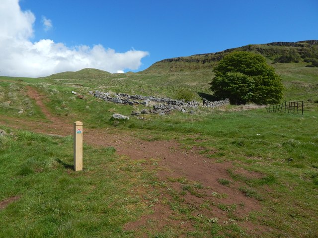
Path beside old sheepfold
The path is marked on the 1:25000 map, as is the old sheepfold, for which see NS4277 : Disused sheepfold / NS4277 : Disused sheepfold. The marker post is recent (see the end-note); below the arrows on it are the words "Black Linn & Doughnot Hill".
Roundwood Hill is directly behind the post, and part of the Long Crags is in the right background.
Roundwood Hill is directly behind the post, and part of the Long Crags is in the right background.
Lang Craigs Woodland :: NS4377
The woodland occupies 240 hectares (590 acres) that were acquired by the Woodland Trust Scotland in 2011. It is named after the Long Crags (or Lang Craigs), a line of cliffs Link making up the facade of the Kilpatrick Hills plateau. Lang Craigs Woodland is one of the 13 Commonwealth Woods, and is an SSSI (Site of Special Scientific Interest). New paths have been laid out (waymarkers were added in May 2015), and about 160 hectares of new native woodland planted.
 Map © Crown Copyright")
TIP: Click the map for more Large scale mapping
- Grid Square
- NS4277, 78 images (more nearby 🔍)
- Photographer
- Lairich Rig (more nearby)
- Date Taken
- Friday, 29 May, 2015 (more nearby)
- Submitted
- Thursday, 11 June, 2015
- Subject Location
-
OSGB36:
 NS 4296 7702 [10m precision]
WGS84: 55:57.6266N 4:31.0321W - Camera Location
-
OSGB36: NS 4294 7700
- View Direction
- Northeast (about 45 degrees)