2015
NY6538 : Summit area of Dun Edge
taken 9 years ago, 4 km E of Melmerby, Cumbria, England
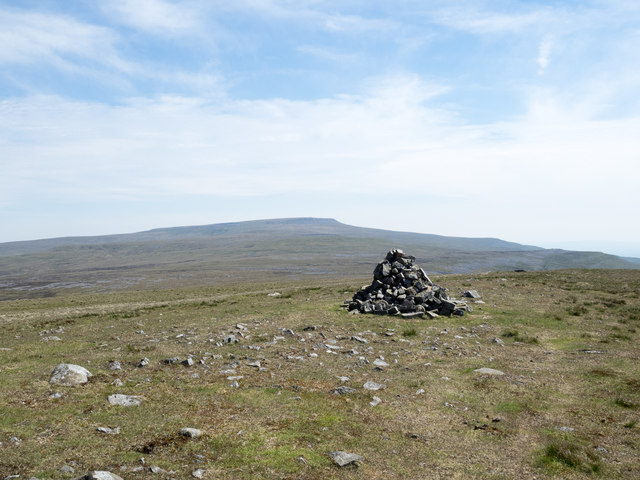
Summit area of Dun Edge
The cairn is the only feature of note at the summit of Melmerby Fell: it's named as Dun Edge on larger scale OS maps. The name is odd; there's nothing anywhere near the summit that could possibly be considered as an edge! Cross Fell lies in the distance.
 Map © Crown Copyright")
TIP: Click the map for more Large scale mapping
- Grid Square
- NY6538, 14 images (more nearby 🔍)
- Photographer
- Trevor Littlewood (more nearby)
- Date Taken
- Friday, 12 June, 2015 (more nearby)
- Submitted
- Saturday, 13 June, 2015
- Subject Location
-
OSGB36:
 NY 6521 3803 [10m precision]
WGS84: 54:44.1619N 2:32.5097W - Camera Location
-
OSGB36: NY 6520 3805
- View Direction
- South-southeast (about 157 degrees)