2007
TM3497 : Looking Down Buck's Hill to Mundham Road
taken 17 years ago, near to Sisland, Norfolk, England
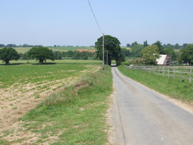
Looking Down Buck's Hill to Mundham Road
On the right, the building undergoing renovation is The Firs. National Cycle Route.
 Map © Crown Copyright")
TIP: Click the map for more Large scale mapping
- Grid Square
- TM3497, 58 images (more nearby 🔍)
- Photographer
- Ian Robertson (more nearby)
- Date Taken
- Saturday, 2 June, 2007 (more nearby)
- Submitted
- Saturday, 2 June, 2007
- Subject Location
-
OSGB36:
 TM 345 979 [100m precision]
WGS84: 52:31.7055N 1:27.4134E - Camera Location
-
OSGB36: TM 346 977
- View Direction
- Northwest (about 315 degrees)