NS3678 : Furrowed area
taken 9 years ago, near to Renton, West Dunbartonshire, Scotland
A flagstaff associated with the rifle range was located not far ahead: NS3678 : Former site of rifle range's flagstaff.
Click on the end-note title for related images.
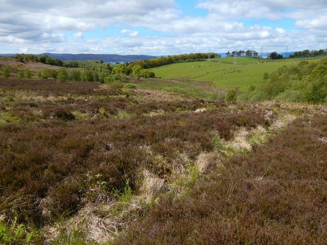
The second-edition OS map (revised c.1897) shows a rifle range here, with flagstaff and targets at the NE end; to the SW, small features are labelled "200", "500", and "600" (distance in yards from the targets). The range is not recorded on the first-edition map (surveyed 1860), nor on the revision of c.1914. Though the area is now damp and tick-infested, its topography was very suitable for its former use: it is low, flat, and level, and surrounded by (contrastingly uneven) higher ground on all sides, which would safely contain all but the wildest of stray shots.
According to page 84 of "Cardross: the village in days gone by" (Arthur F Jones, 1985), the 7th (Cardross) Company of the Dumbarton Volunteer Rifles came into being late in 1859, and, for their shooting competitions, "at first a field at Carman was used", before ground was secured near the shore at Cardross in 1864. It is not clear whether the "field at Carman" is the one shown here.
 Map © Crown Copyright")
- Grid Square
- NS3678, 137 images (more nearby 🔍)
- Photographer
- Lairich Rig (more nearby)
- Date Taken
- Monday, 8 June, 2015 (more nearby)
- Submitted
- Saturday, 20 June, 2015
- Subject Location
-
OSGB36:
 NS 3674 7897 [10m precision]
WGS84: 55:58.5522N 4:37.0744W - Camera Location
-
OSGB36: NS 3674 7897
- View Direction
- West-southwest (about 247 degrees)