NS3678 : View over former site of rifle range's targets
taken 9 years ago, near to Cardross, Argyll And Bute, Scotland
In this connection, it occurred to me that heavy metals or other toxins from spent ammunition, especially if occurring in high concentrations, as they would here, might inhibit growth of some plant species for a long time, and that this might account for the bare appearance of the soil here. That does indeed appear to be the case; in fact, the target areas of old rifle ranges have at times been made the subject of ecological studies for that very reason.
It seems that the main contaminant in such areas is lead. For example, the title of one paper devoted to the subject is "The ecology of an old rifle range target area with lead poisoned soil" (Hugh A. McAllister, 1965) [The Biol. J. (Zoology Department, St. Andrews University), 5: 10-11].
Compare NS3678 : Former site of rifle range's targets, a view in the opposite direction over the same dark, bare patch; the accompanying description comments further on why, topographically, this was a good location for the targets.
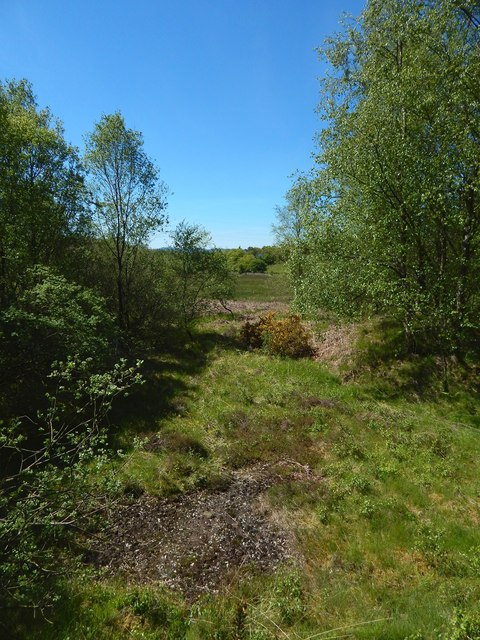
The present picture is a view along the length of the rifle range, looking in the direction from which firing would have come. The second-edition map marks shooting positions 200, 500, and 600 yards from these targets. I have not depicted the first of these, since it is in a particularly damp area where traces are not sufficiently well preserved to be worth showing; however, for the other two shooting positions, see NS3678 : Traces of 500-yard shooting position and NS3678 : Traces of 600-yard shooting position.
Incidentally, at the far (south-western) end of the range, a few yards from the 600-yard shooting position, was another structure, marked but not labelled on the second-edition OS map. The ground at its likely location has a similar bare appearance, as shown at NS3678 : View along former rifle range, though there are several possible explanations (for example, some spent shell-cases might have been brought back there from the target area; or the toxins might have leached, instead, from live ammunition at that end of the range; or related activities beside the firing position there might have produced lead dust; there are many possibilities).
Click on the end-note title for related pictures.
The second-edition OS map (revised c.1897) shows a rifle range here, with flagstaff and targets at the NE end; to the SW, small features are labelled "200", "500", and "600" (distance in yards from the targets). The range is not recorded on the first-edition map (surveyed 1860), nor on the revision of c.1914. Though the area is now damp and tick-infested, its topography was very suitable for its former use: it is low, flat, and level, and surrounded by (contrastingly uneven) higher ground on all sides, which would safely contain all but the wildest of stray shots.
According to page 84 of "Cardross: the village in days gone by" (Arthur F Jones, 1985), the 7th (Cardross) Company of the Dumbarton Volunteer Rifles came into being late in 1859, and, for their shooting competitions, "at first a field at Carman was used", before ground was secured near the shore at Cardross in 1864. It is not clear whether the "field at Carman" is the one shown here.
 Map © Crown Copyright")
- Grid Square
- NS3678, 137 images (more nearby 🔍)
- Photographer
- Lairich Rig (more nearby)
- Date Taken
- Wednesday, 10 June, 2015 (more nearby)
- Submitted
- Saturday, 20 June, 2015
- Subject Location
-
OSGB36:
 NS 3667 7899 [10m precision]
WGS84: 55:58.5616N 4:37.1424W - Camera Location
-
OSGB36: NS 3667 7899
- View Direction
- Southwest (about 225 degrees)