2015
SP2461 : Nineteenth-century benchmark on Hillcrest
taken 9 years ago, near to Sherbourne, Warwickshire, England
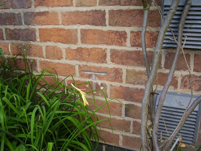
Nineteenth-century benchmark on Hillcrest
This bench mark was established between 1850 and 1856 during the First primary levelling of England & Wales, and was levelled with a height of 285.5160 feet [87.0253 metres] above mean sea level (Liverpool datum). It was included on the Basingstoke to Coventry levelling line. The surveyor's description was "No. 195. Mark on front of house at South side of road, Sherbourn Hill ; 1.65 ft. above surface" (Public Abstract p.240).
 Map © Crown Copyright")
TIP: Click the map for more Large scale mapping
- Grid Square
- SP2461, 18 images (more nearby 🔍)
- Photographer
- Shantavira (more nearby)
- Date Taken
- Tuesday, 23 June, 2015 (more nearby)
- Submitted
- Wednesday, 24 June, 2015
- Subject Location
-
OSGB36:
 SP 2475 6130 [10m precision]
WGS84: 52:14.9596N 1:38.3334W - Camera Location
-
OSGB36: SP 2475 6130
- View Direction
- Southeast (about 135 degrees)