2015
NH1334 : Summit Ridge to the East of An Riabhachan
taken 9 years ago, near to Toll na Feurstaig [other Features], Highland, Great Britain
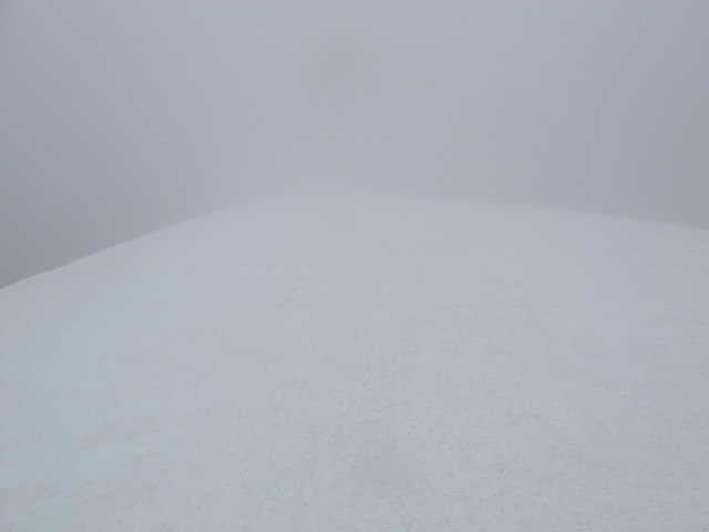
Summit Ridge to the East of An Riabhachan
Not much to see, but I submitted this to show the near white out conditions experienced on 23-June. The ridge was covered in moderately hard snow and there were cornices to the left of the picture. At one point the line between land and sky could not be determined. Need to be careful!
 Map © Crown Copyright")
TIP: Click the map for more Large scale mapping
- Grid Square
- NH1334, 7 images (more nearby 🔍)
- Photographer
- Alan Hodgson (more nearby)
- Date Taken
- Tuesday, 23 June, 2015 (more nearby)
- Submitted
- Friday, 26 June, 2015
- Subject Location
-
OSGB36:
 NH 1377 3474 [10m precision]
WGS84: 57:21.8957N 5:5.8905W - Camera Location
-
OSGB36: NH 1359 3468
- View Direction
- East-northeast (about 67 degrees)