2015
TQ2982 : Former petrol station, Hampstead Road
taken 9 years ago, near to Camden Town, Camden, England
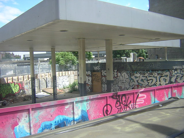
Former petrol station, Hampstead Road
Much is made of the number of pubs that close down, but a similar cull seems to be taking place almost unnoticed when it comes to petrol stations. Anyone needing to fill up a vehicle in central London faces an uphill struggle: particularly difficult when one needs to return a hire car or van with the tank full. This awkward little triangular site hosted a very useful BP station until a couple of years ago; I suspect it may be a casualty of the HS2 railway works shortly to affect this area.
 Map © Crown Copyright")
TIP: Click the map for more Large scale mapping
- Grid Square
- TQ2982, 2044 images (more nearby 🔍)
- Photographer
- Christopher Hilton (more nearby)
- Date Taken
- Monday, 22 June, 2015 (more nearby)
- Submitted
- Saturday, 27 June, 2015
- Subject Location
-
OSGB36:
 TQ 2922 8295 [10m precision]
WGS84: 51:31.8408N 0:8.3103W - Camera Location
-
OSGB36: TQ 2920 8297
- View Direction
- East-southeast (about 112 degrees)