SD7807 : Moorhen (Gallinula chloropus) on Manchester Bolton and Bury Canal
taken 9 years ago, near to Radcliffe, Bury, England
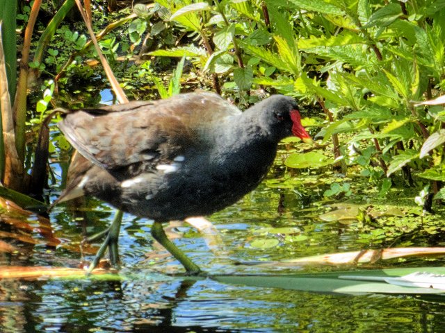
Unlike mallards, moorhens and coots are not ducks, but are members of the rail family Rallidae. Coots and moorhens are similar in size and colour of plumage but, whereas the Coot is mostly black and has a distinctive white front face shield and beak, the Moorhen has dark brown back wings and a more bluish-black belly. They also have a red frontal face shield and beak with a yellow tip. Moorhens also have and long, green legs.
Moorhens take their common name, not from the moor as it suggests (they are seldom seen in a moorland habitat). In this case moor is possibly a corruption of mere (meaning water), hence the birds alternative common name of water hen (hen because the birds feet are like those of a hen).
Link
Link
The Manchester Bolton & Bury Canal is a disused canal, built to link Bolton and Bury with Manchester. The canal, when fully completed in 1796, was 15 miles long. It was connected with the River Irwell in Salford, in 1808.
From Salford the canal ran up the Irwell valley to reach Nob End, where it climbed the Prestolee Locks, and then split into two branches leading to Bolton and Bury. The canal was built principally to serve the many collieries in the area, as well as to transport other cargo such as stone and timber.
By 1846 a parallel railway had been built to Bury, and the canal went into decline. The Bolton arm went out of use in 1924, though with some minor use until 1947. The Bury arm was breached just above Nob End in 1936, but the then isolated Bury arm continued to be used until 1951, principally between the canalside Ladyshore Colliery and Bury. The final section of the canal was officially closed in 1961, and much of it was filled in.
.
LinkExploring Greater Manchester, a fieldwork guide (web edition); edited by Paul Hindle, Manchester Geographical Society
Link
Link
Link
 Map © Crown Copyright")
- Grid Square
- SD7807, 934 images (more nearby 🔍)
- Photographer
- David Dixon (more nearby)
- Date Taken
- Tuesday, 23 June, 2015 (more nearby)
- Submitted
- Sunday, 28 June, 2015
- Subject Location
-
OSGB36:
 SD 786 077 [100m precision]
WGS84: 53:33.9715N 2:19.4569W - Camera Location
-
OSGB36: SD 786 077
- View Direction
- NORTH (about 0 degrees)