2009
TQ0107 : 17 and 19 High Street, Arundel
taken 15 years ago, near to Arundel, West Sussex, England
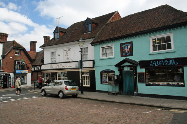
17 and 19 High Street, Arundel
Grade II Listed late 17th century buildings. Number 17 has been serving groceries to the population for at least one hundred years and was known as Denton's Stores at the beginning of the 20th century. Mark Robinson & Jonathan Brantigan took the business over in May 2007. The surviving island of buildings in High Street which includes 17 and 19 was in existence by the early 15th century, when five shops and a shamble were recorded. The two buildings represent the increasing use of brick in the town in the 17th century.
 Map © Crown Copyright")
TIP: Click the map for more Large scale mapping
- Grid Square
- TQ0107, 1098 images (more nearby 🔍)
- Photographer
- Jo and Steve Turner (more nearby)
- Date Taken
- Tuesday, 22 September, 2009 (more nearby)
- Submitted
- Sunday, 28 June, 2015
- Subject Location
-
OSGB36:
 TQ 0190 0707 [10m precision]
WGS84: 50:51.2508N 0:33.2231W - Camera Location
-
OSGB36: TQ 0188 0708
- View Direction
- Southeast (about 135 degrees)