2015
ST9819 : Shire Rack meets Longcroft Road
taken 9 years ago, near to Deanland, Dorset, England
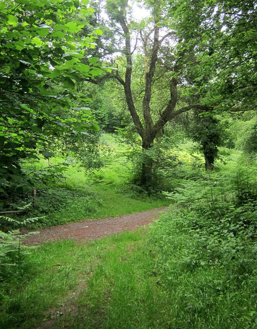
Shire Rack meets Longcroft Road
The path in the foreground, crossing the main track, is the Shire Rack, the county boundary between Dorset (right) and Wiltshire. It seems to be considered a Dorset path, number E52 30. As it crosses it, the main track turns from (Wiltshire, left) EWAK 19 to (Dorset) E52 26.
 Map © Crown Copyright")
TIP: Click the map for more Large scale mapping
- Grid Square
- ST9819, 13 images (more nearby 🔍)
- Photographer
- Derek Harper (more nearby)
- Date Taken
- Friday, 26 June, 2015 (more nearby)
- Submitted
- Monday, 29 June, 2015
- Subject Location
-
OSGB36:
 ST 9811 1909 [10m precision]
WGS84: 50:58.2733N 2:1.6974W - Camera Location
-
OSGB36: ST 9810 1909
- View Direction
- EAST (about 90 degrees)