2015
SK1385 : Buttercup field in Edale
taken 9 years ago, near to Edale, Derbyshire, England
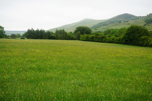
Buttercup field in Edale
The valley bottom of Edale with Lose Hill and Back Tor making the lumps on the right.
 Map © Crown Copyright")
TIP: Click the map for more Large scale mapping
- Grid Square
- SK1385, 60 images (more nearby 🔍)
- Photographer
- Bill Boaden (more nearby)
- Date Taken
- Saturday, 20 June, 2015 (more nearby)
- Submitted
- Tuesday, 30 June, 2015
- Subject Location
-
OSGB36:
 SK 1308 8536 [10m precision]
WGS84: 53:21.8971N 1:48.2943W - Camera Location
-
OSGB36: SK 1303 8535
- View Direction
- EAST (about 90 degrees)