2015
TM2172 : Dragon House, Horham
taken 9 years ago, near to Horham, Suffolk, England
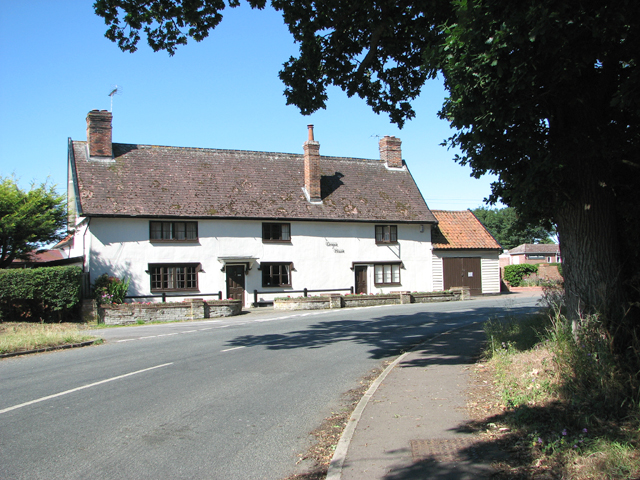
Dragon House, Horham
During WW2, this private dwelling used to be a public house called The Dragon Inn. It was one of the favourite haunts of the men of the 95th Bomb Group who were based at RAF Horham.
RAF Horham (USAAF Station 119)
RAF Horham is located to the south-east of Eye and straddles the parishes of Denham, Horham, Redlingfield and Hoxne. Built for the Royal Air Force (RAF) it was one of the earliest heavy bomber bases opened in East Anglia. In 1942, the base was handed over to the United States Army Air Forces (USAAF) and designated Station 119. The aerodrome's history and a number of original buildings are preserved at two local museums - the 95th Bomb Group Hospital Museum > Link
and the nearby 95th Bomb Group Museum > Link
 Map © Crown Copyright")
TIP: Click the map for more Large scale mapping
- Grid Square
- TM2172, 114 images (more nearby 🔍)
- Photographer
- Evelyn Simak (more nearby)
- Date Taken
- Friday, 3 July, 2015 (more nearby)
- Submitted
- Friday, 3 July, 2015
- Subject Location
-
OSGB36:
 TM 2108 7234 [10m precision]
WGS84: 52:18.2790N 1:14.4805E - Camera Location
-
OSGB36: TM 2112 7236
- View Direction
- West-southwest (about 247 degrees)