2015
J5776 : Ballycopeland windmill, Millisle (July 2015)
taken 9 years ago, near to Millisle, Co Down, Northern Ireland
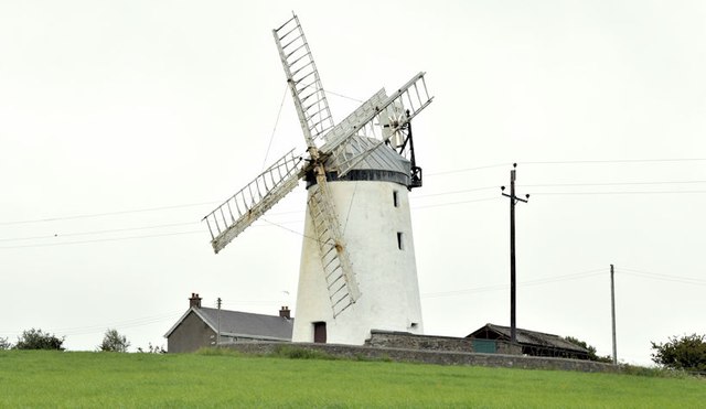
Ballycopeland windmill, Millisle (July 2015)
The windmill seen from the southwest on the Windmill Road.
Ballycopeland windmill, Millisle
Ballycopeland windmill was built in about 1785. It came into state care in 1935 and has been the subject of several restoration schemes. Thought to be the only intact windmill in working order in Co Down.
Loading map... (JavaScript required)
- Grid Square
- J5776, 29 images (more nearby 🔍)
- Photographer
- Albert Bridge (more nearby)
- Date Taken
- Friday, 3 July, 2015 (more nearby)
- Submitted
- Friday, 3 July, 2015
- Subject Location
-
Irish:
 J 579 760 [100m precision]
WGS84: 54:36.4669N 5:33.3802W - Camera Location
-
Irish: J 578 759
- View Direction
- East-northeast (about 67 degrees)