2004
SM8002 : St. Anns Head, Cobblers Hole
taken 20 years ago, 3 km from Dale, Pembrokeshire/Sir Benfro, Wales
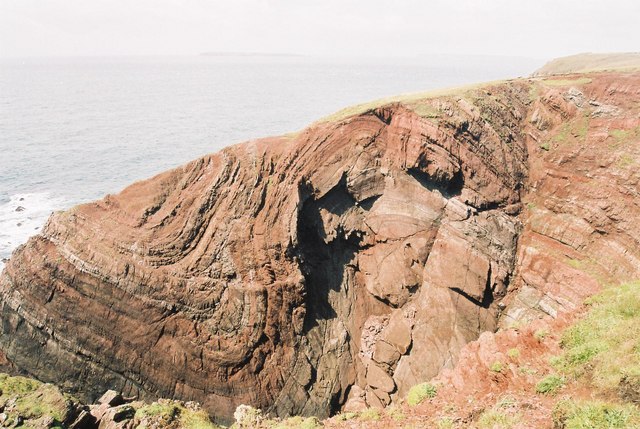
St. Anns Head, Cobblers Hole
This interesting rock formation is just along from the lighthouse. It is not dissimilar to the Lulworth Crumple in Dorset SY8279 : Stair Hole.
 Map © Crown Copyright")
TIP: Click the map for more Large scale mapping
- Grid Square
- SM8002, 47 images (more nearby 🔍)
- Photographer
- Chris Downer (more nearby)
- Date Taken
- Tuesday, 17 August, 2004 (more nearby)
- Submitted
- Monday, 4 June, 2007
- Subject Location
-
OSGB36:
 SM 805 028 [100m precision]
WGS84: 51:40.8572N 5:10.5908W - Camera Location
-
OSGB36: SM 805 027
- View Direction
- West-northwest (about 292 degrees)